It was hard to concentrate on the road with all this beauty in front of me; mountains, lakes, green hills with sheep, cows, trees in autumnal colours and now and then a house or a street which would be a tiny village. Half way the weather started to get colder and I could see clouds and rain on the horizon. I stopped off at Te Anau which is situated beside the lake bearing its name and is the second largest lake in NZ. The town is renowned as a great starting point for the Milford, Routeburn and Kepler tracks so I decided to stay here for the night. At the hostel I was told that the road to Milford was closed due to the snow and lots of fallen trees on it and this could be the case till the weekend (I was there on Wednesday). This was a big surprise for me and I was a bit taken back that my plan wouldn’t work out as I would like to but that’s just part of traveling.
The next day I travelled part of the road to Milford till I couldn’t get any further so at least I saw some of the views and stunning alpine drive along Milford Road. I stopped off at Lake Mistletoe for a walk and drove along the route 94 with some photo stops in between rain, hail and snow.
I decided that I just had to continue my road trip instead of waiting for the weather to clear for a further exploration of the Milford Sound area.
My destination for that night would be Aoraki/ Mt Cook so I started the 5 hour trip via Queenstown to this area. Again my eyes were pleasantly entertained with beautiful views of this area and if I thought I was used to the scenery I turned another mountain pass and there were more icing-sugar-like dusting of snow on top of the mountains along the Lindis Pass and I was speechless of the views I saw. The 700km Aoraki/Mt Cook National Park is spectacular along with Fiordland and Westland National Parks, it has over 22 mountains in this park, the highest is the mighty Mt Cook – at 3755m, known to Maori as Aoraki (Cloud Piercer). When I passed Twizel I knew I was almost at my destination but not till I followed the winding road along Lake Tasman.
It was almost getting dark so I just wanted to reach Mount Cook village and enjoy more of it in the morning.
The following day I woke up with the view of snow covered roads, cars, Mount Wakefield and the tip of Mt Cook from my hostel room. The sun was shining so I decided to start the walk to the Hooker Valley with views of Mt Wakefield via two swing bridges until the final destination of the Terminal Lake at the bottom of the Hooker Glacier which should give you clear views of Mount Cook. However the clouds were in the way so it was a partial view of the famous mountain. (A couple of days after I’ve left in two separate accidents people died during a track on the Hooker Glacier which does make you think that nature is beautiful but can be dangerous too.)
After lunch I made my way via Twizel -for coffee with an apple cinnamon muffin- to Lake Tekapo. Most of the route is along Lake Pukaki, the blazing turquoise colour of Lake Pukaki a characteristic it shares with other regional lakes such as Lake Tekapo, this is due to sediment in the water. These sediments were created when the lake’s basin was gouged out by the glacier moving across the land’s surface, with the rock-on-rock action grinding out fine particles that ended up being suspended in the melt water. This sediment gives the water a milky quality and refracts the sunlight beaming down, hence the brilliant colour (and great for photo shots). Many times I had to stop for some Kodak moments but I feel that what my eyes saw the camera can’t copy in that tiny frame. I had many ohh and ahh moments by myself in the car and I’m still gobsmacked how beautiful and amazing this country is. I’m so pleased that I decided to have a mini road trip as I wouldn’t have experienced this with the Kiwi bus.
That evening I’d put my head to rest in Lake Tekapo with a hostel facing the lake so I was in for a treat with views of the lake at sunset and rise.
My day at Lake Tekapo had blue skies and sun so a perfect day for the Mt John summit and lakeshore hike. Part of the summit showed the wide country side and amazing lake views but when I’ve reached the summit it was the best view of the lake for sure. At the top there is a coffee place with the most expensive cappuccino I had in ages but it was worth the money with this view. After a short stop I carried on from the walkway in zigzags down the Eastern face of the Mt John to the lakeshore. The views were stunning with the ‘Tekapo’ blue water and it was as silent as there were hardly other hikers on the horizon.
Later that day I went to the other side of the lakeshore for more views at the Church of the Good Shepherd ( in memory of the pioneers of the area) and the Sheep Dog statue ( a tribute to the collie dog as without their help the grazing of this mountain area would have been impossible).
The evening had a great treat too as Lake Tekapo has an amazing Japanese restaurant with one of the best sashimi’s I’ve tasted with fresh salmon from the nearby salmon farm.
The following day I left the lake in sunshine to my next destination; Arthurs Pass which is based in the National Park with the same name and renowned for its tramping tacks. I started driving on the National Highway 79 towards Geraldine which was recommended by many so I stopped there early Sunday morning for brunch. This little place has a creative streak with some market stalls from locals selling their knitted range or delicatessen shops selling chocolate, cheese and pies. Within 5 minutes walking around the quiet street with shops the locals started chatting or asking if I was a tourist and what my plan was.
In the little café I had brunch and got my free Wi-Fi fix too, with a full tummy I carried on along the scenic route 72 which was stunning in the sunshine. It was hard to concentrate on the road with all this beauty around me. The mountains stayed in the background with the icing sugar dusting tops and on the lower ground I saw green fields with many cows and sheep. Unfortunately there is a lot of road kill so I had to avoid many dead rabbits, falcons and possums.
Around midday I passed Castle Hill which is an area with rock formations from limestone and have been here for thousands years. The site is very big so you can walk around them and it’s encouraged to use them for bouldering or climbing. The Chronicles of Narnia: The Lion, the Witch and the Wardrobe were here filmed too. After a walk around the site I continued and left the scenic route 72 just after Methven which is the village for the Mt Hutt ski area. In winter this is a busy place but in summer it calms down for obvious reasons. From there it was Highway 73 to take me to Arthurs’s Pass National park via the mountain pass. Luckily the weather was good as in bad weather condition this could be harder to navigate and more dangerous.
Arthur’s Pass village is 4km from the pass of the same name and is NZ’s highest-altitude
settlement and is a tiny one road village with some places to stay, as it’s a handy base to use for tramps, hikes or skiing in wintertime.
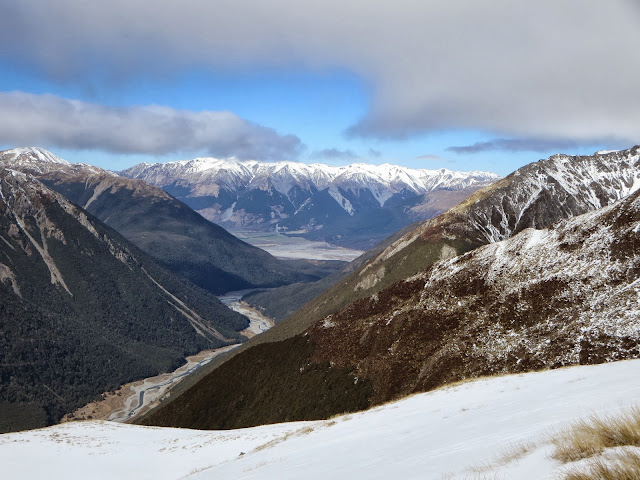
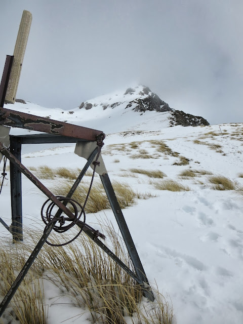
I did Scotts track which offers 360-degree views of snow-capped peaks, many of them over
2000m; the highest is Mt Murchison (2400m), I wasn’t planning to climb to the summit as there was too much snow and clouds to get there safe. Near the highest point I met a Canadian couple that tried to reach the summit but had to return due to the weather conditions. On my return down to the village I had beautiful views of the Devils Puchbowl waterfall.
The following day I was leaving the mountains behind for the Banks peninsula; the Peninsula and its hills were formed by two giant volcanic eruptions about 8 million years ago. The historic town of Akaroa is a highlight, as is the absurdly beautiful drive along Summit Rd around the edge of the original crater.
Akaroa (‘Long Harbour’ in Maori) was the site of the country’s first French settlement; descendants of the original French settlers still reside here. It’s a charming town that strives to re-create the feel of a French provincial village.
The final day of my road trip was a beautiful sunny day and perfect for the scenic route through the mountains and the bays formed by the three volcano eruptions. The views are stunning as on the West side you see Akaroa and Robinson Bay and on the East side the bays with the sea and snow covered mountains in the distance.
I went down the roads to Long Bay and had a rest on the deserted beach of Le Bons Bay. There wasn’t a soul to be seen only some houses dotted along the roads or at the sea front. The mountains are covered in green carpeted fields with cows, sheep or many trees. I followed the summit road and tourist drive before making my way back to Christchurch via the state highway 75 but not after I’ve visited Cheese factory Barrys Bays. I was expecting a tour and some tasting but it was just a shop where they also made Edam, Gouda and Maaslander cheese which tastes quite similar as the Dutch version.
The road trip came to an end by dropping off my car in Christchurch were I would join the kiwi Experience the next day.
 |
| Lake Wakatipu |
 |
| Lake Wakatipu |
 |
| Mt Cook and Mt Wakefield |
 |
| Lake Abel Tasman |
 |
| Lake Tekapo |
 |
| Castle Hill |
 |
| Arthur's Pass |
 |
| Views from Arthur's Pass |
 |
| Akaroa harbour |
 |
| Akaroa |


No comments:
Post a Comment